Likoma Island has about 9,000 residents by commonly quoted estimates. It is a small island in Lake Malawi, only around 18 to 20 square kilometres in area, and it is administered by Malawi even though it lies just off the coast of Mozambique.
Likoma Island population: the numbers
| Measure | Figure |
|---|---|
| Likoma Island (commonly quoted estimate) | About 9,000 |
| Likoma District, 2018 census (Likoma and Chizumulu islands) | 14,527 |
| Area of Likoma District | About 20 km² |
Population figures for small islands vary by source and by how the boundary is drawn. The island estimate is the commonly quoted figure, and the district figure comes from Malawi's 2018 census, as summarised on Wikipedia. Either way, Likoma is one of the most densely populated places in the country.
Where is Likoma Island?
Likoma sits in the north-east of Lake Malawi, close to the Mozambican shore near Cóbuè. Despite the proximity, it belongs to Malawi, along with its smaller neighbour, Chizumulu. A 1954 agreement set the lake's border at the midline but left both islands with Malawi, and together they form Likoma District, the smallest district in the country. The lake is also known as Lake Nyasa, and Likoma is one of its two main inhabited islands. See Likoma Island on Wikipedia.
What it is like
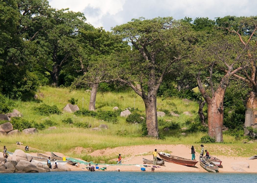
Likoma is a small, quiet island with rocky slopes, sandy bays and old baobab trees. Most people are fishermen and their families, and the pace of life follows the lake. There is an airstrip on the main island. The island's history is tied to the missionary era, and its large Anglican cathedral, St Peter's, is a landmark in Likoma town. We have written separately about the culture, cathedral and Kaya Mawa, and about the people of the circuit.
Underwater, Lake Malawi is one of the richest freshwater habitats on earth, with hundreds of cichlid species, many found nowhere else. It is a UNESCO World Heritage Site for its fish diversity, though the listed area is the national park at the southern end of the lake rather than Likoma itself.
How to get to Likoma
- By air: small charter aircraft fly to the airstrip, which is how most luxury travellers arrive.
- By lake: the historic Ilala ferry connects Likoma with towns on the Malawian shore on a scheduled service, subject to its running schedule.
- Entry requirements: US and UK travellers now need a Malawi e-Visa (see our visa guide).
Why Likoma ends our circuit
Likoma is where our four-country journey comes to a close. After the rivers and floodplains of Zambia and Zimbabwe and the coast of Mozambique, Lake Malawi is a deliberate change of pace: warm freshwater, a quiet island and time to let the journey settle. The final flight from Likoma returns guests to Lilongwe for their onward connections. Read more about why we end on Lake Malawi, and how long the whole trip takes in our flight times guide.
Sources: Wikipedia, Likoma District (2018 census, 14,527) and Wikipedia, Likoma Island. The island-only population is an estimate. Checked November 2026.
Frequently asked questions
What is the population of Likoma Island?
About 9,000 people on the island by commonly quoted estimates. Likoma District, which includes neighbouring Chizumulu, had 14,527 residents at the 2018 census.
Where is Likoma Island?
In Lake Malawi, close to the Mozambican shore, but part of Malawi.
How big is Likoma Island?
Roughly 18 to 20 square kilometres, about 7 to 8 square miles.
Is Likoma Island worth visiting?
Yes, for its quiet beaches, baobabs, cichlid-rich water and sense of remoteness.